
Atlantic Basin Hurricane Development
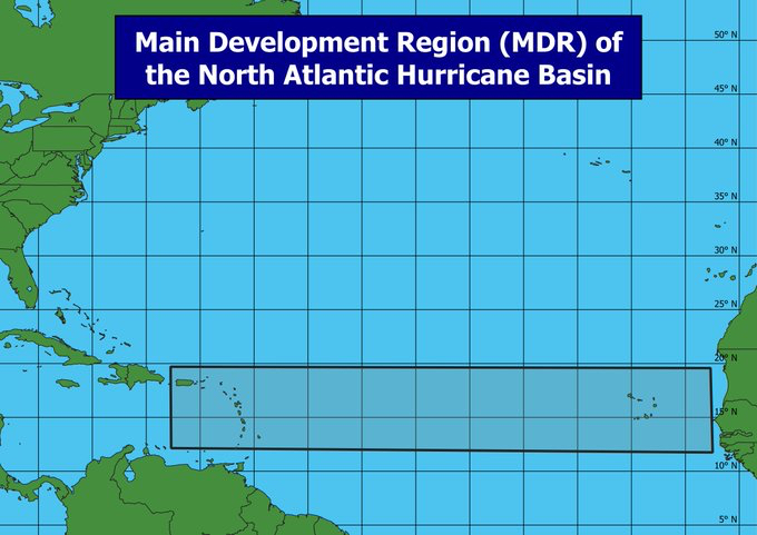
The initial low pressure centers which result in tropical cyclones in the Atlantic basin in the Northern Hemisphere often start as storm systems over West Africa. During active periods of the West African Monsoon, or WAM, low pressure systems will repeatedly move with the trade winds off the west coast of Africa into the Atlantic Ocean. These low pressure systems may be referred to as tropical waves, or tropical easterly waves, before they have a chance to develop a complete counter-clockwise circulation around the low pressure center. If the conditions are right with warm sea surface temperatures and relatively low vertical wind shear, these tropical waves may develop into tropical cyclones. They will initially progress toward the west with the trade winds in the tropics and continue toward the northwest due to Beta Drift as they mature in the Northern Hemisphere. This results in a region of frequent tropical cyclone development between the west coast of Africa and the Caribbean Sea. This area is referred to as the Main Development Region, where a significant portion of the tropical cyclones within the Atlantic basin develop.
Storms which develop off the coast of West Africa and remain in the subtropics as they drift westward are often referred to as Cape Verde storms because they form near the Cape Verde islands off the coast of West Africa. Cape Verde storms are often associated with a strong, subtropical ridge over the North Atlantic Ocean, which promotes westward tracks towards the Caribbean Sea and the Southeast United States.

Saharan Air Layer
The Saharan Air Layer, or SAL, refers to a layer of hot, dry, and often dusty air coming off the coast of West Africa into the North Atlantic Ocean. The SAL can result in strong wind shear and cooler sea surface temperatures, which together suppress tropical cyclone formation in the Atlantic basin. SAL events are clearly evident on satellite imagery as dust plumes result in haze on visible satellite imagery.